
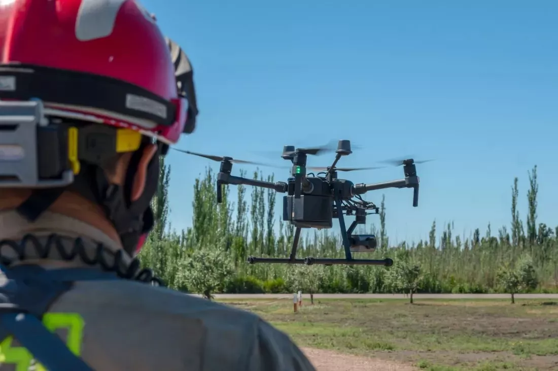
A forest fire or a flood means chaos: smoke, water, broken communication lines and dozens of teams that have to act together. The EU-funded OVERWATCH project combines data from satellites and drones, artificial intelligence and augmented reality so that rescuers can understand faster what is happening on the ground. The system was put to the test during exercises in Portugal and Poland – and at the end you can check how well you keep a cool head when every piece of information counts.
The effects of climate change are already being felt across Europe. As temperatures rise, disasters such as floods and wildfires become more frequent and more severe, and people’s lives are increasingly at risk. For emergency services, this means harder operations in which decisions have to be made quickly, often on the basis of incomplete information.
The OVERWATCH project, funded by the EU and coordinated by Vanina Fissore from the Italian innovation SME Ithaca, set out to close this gap. Its team built a system in which holography, drones and artificial intelligence work together to help first responders manage climate-related disasters.
The project started by naming the challenges that response and recovery teams struggle with during a crisis. They can be summed up in three points:
There is also the safety of the rescuers themselves. “Additionally, reconnaissance missions can be dangerous for personnel, especially in unstable or inaccessible environments,” explains the project coordinator. Her conclusion is simple: “Many of these tasks could be performed safely using unmanned systems.”
At the heart of OVERWATCH is Earth observation. The system collects data from satellites and drones and then processes it with artificial intelligence tools. In this way, raw images and measurements turn into information that a commander can use straight away. Satellites offer the wide view, while drones make it possible to take a closer look at a specific place – together they give a fuller picture of the event.
Fissore puts it this way: “By integrating data from satellites and drones, and presenting it through intuitive interfaces such as web dashboards and augmented reality, the system helps teams better understand evolving conditions on the ground.”
Even the best data is useless if it cannot be sent. That is why the project relies on resilient communication through fallback networks supplied by tethered drones. When the usual infrastructure fails, these networks are meant to keep the connection going between the teams in the field and the people coordinating the operation.
The system also supports autonomous reconnaissance, so some dangerous tasks can be handed over to machines instead of people.
The most striking part of the system is the way it shows information. It includes a holographic and augmented reality (AR) element that runs on specialised visors. The coordinator describes it like this: “The AR component enables firefighters and civil protection commanders to visualise the same information available on the web dashboard – such as live maps, fire perimeters, drone positions and flood data – directly overlaid onto their physical surroundings.”
In practice, a firefighter does not have to keep looking from a screen to the terrain and back, because the key data appears against the background of what is right in front of them. “Instead of relying on fragmented and delayed information, commanders can access a clearer, real-time picture of the situation, enabling faster and more informed decisions,” Fissore adds.
The system was not developed only in the lab. It was trialled in real-world scenarios: a wildfire exercise in Portugal and a demonstration of the system’s tools in Poland, where the scenario was about floods. Practitioners and end users were able to test the full system, including all platform functionalities and the AR interface. The events brought together civil protection agencies, military units and emergency responders from different countries, who exchanged knowledge and operational experience.
The researchers are refining the system on the basis of user feedback. To gather it, the team offered a free 30-day trial, so that emergency management agencies and other interested users could get hands-on experience with the platform.
OVERWATCH shows that space technology is not only about rockets and telescopes. Satellite data comes down to Earth and helps people in very concrete situations. A project like this needs specialists in Earth observation, artificial intelligence, communication, interface design and crisis management. For anyone choosing a degree or a thesis topic, it is a sign that combining several fields can be worth more than a narrow specialisation.
The way the team works is worth noticing too: tests with future users, collecting feedback and making improvements. This approach is useful in any project, from a university assignment to a professional one.
OVERWATCH combines satellites, drones, artificial intelligence and augmented reality to help emergency services respond to wildfires and floods. It tackles three problems: the lack of an up-to-date picture of the situation, communication failures and difficult coordination. In the long term, the team hopes that platforms like this will strengthen Europe’s overall resilience to climate-related disasters and help reduce their impact on people, infrastructure and the environment.
This article is based on material published by the European Commission’s CORDIS service.
5 questions · one minute


 EN

 CS
 DE
 ES
 FR
 HU
 IT
 PL
 PT
 РУ
 SK
 TR
 УК
 AR
 中文