
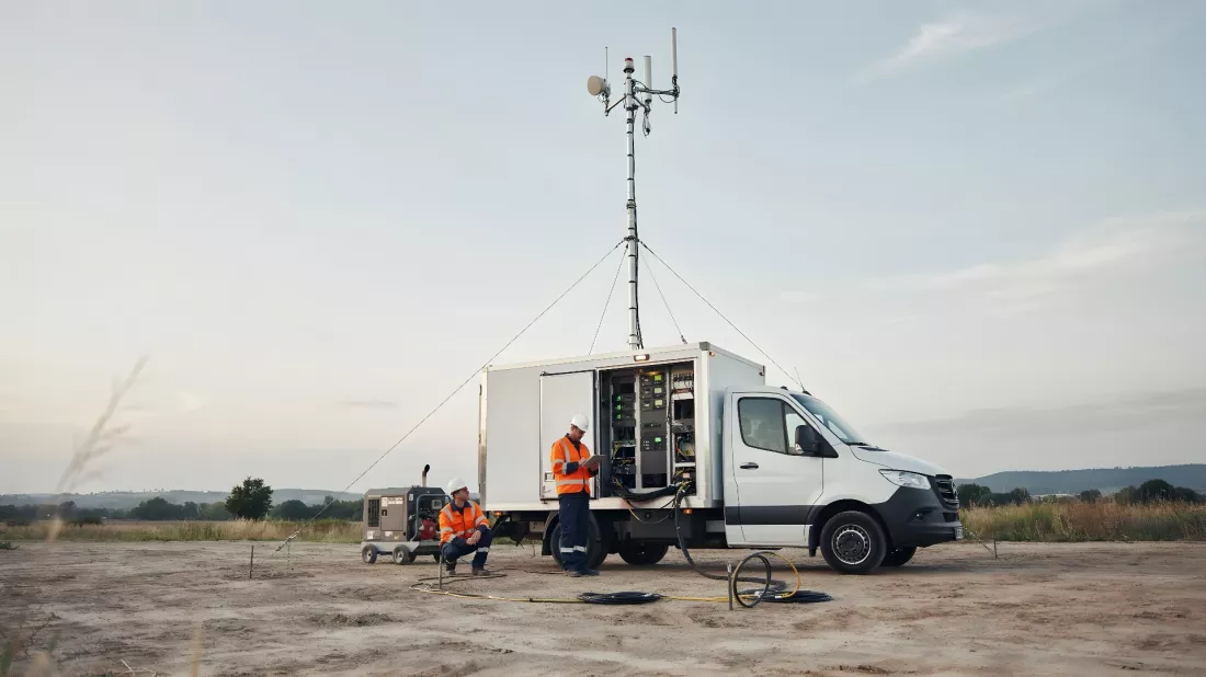
An earthquake, a flood or a fire can knock out phone coverage within moments, and that is exactly when communication matters most. The European GEXTRECS project looked at how to make sure emergency services do not lose contact even when the ground network is down. Satellites, a clever algorithm and the EU space programme come into play. We describe how it works and how the dress rehearsal with a simulated disaster went — and at the end you can check how you would cope with communication in a crisis.
Most of us treat phone coverage like air: it is there, so we do not think about it. The trouble starts when disaster strikes. A flood, an earthquake, a fire or a human-made emergency: in every one of these situations an effective rescue operation depends on whether people in the field can talk to each other. And ground infrastructure, meaning masts and cables, can simply be destroyed at such moments.
That is why secure satellite communications, known as SATCOM, play a growing role. They let emergency services coordinate their work, exchange information and better understand what is happening on the spot. Authorities, in turn, can send out warnings, evacuation orders and safety instructions.
It sounds great, but in practice bringing satellites into rescue operations still causes quite a few problems. The team of the GEXTRECS project, funded by the EU’s Horizon Europe programme, listed the most important ones:
The project was coordinated by the Spanish company GMV Aerospace and Defence and led by Gema Rueda Montenegro. As she puts it, the team made its priority “tackling the complex processes for getting satellite feeds” and the challenges that come with them.
The consortium brought together eight partners from four EU countries: Germany, Italy, Spain and Poland. They combined institutional, industrial, operational and communications expertise.
Their shared goal was a pre-operational crisis management service pack for GOVSATCOM, the EU’s governmental satellite communications. It was to be secure, interoperable, quick to deploy, affordable and user friendly. About EUR 1.5 million was set aside for it, and the work ran from February 2024 to the end of January 2026.
At the core of the solution is a tool called the Dynamic Planner. It looks for the best available satellite resources, depending on what is free at the moment and what the rescuers need. As the coordinator explains, the algorithm “considers factors such as service type, priority level and performance requirements”.
The system also copes with congestion when demand suddenly rises, and it can replan the allocation of resources on the fly. First responders order services through a dedicated web interface.
The second element is the GEXTRECS Network Balancer. This module switches traffic between different satellite channels, and also between satellites and the terrestrial network. The point is that a call or a data transfer does not drop at the worst possible moment.
The project did not stop at communications alone. The team also looked at using secure positioning based on Galileo and at transmitting products of the Copernicus service. These are all parts of the EU space programme, which here were meant to work together with satellite communications.
As a result, the solution can give rescuers not only a channel for talking but also an exact position and geographic information about the terrain.
Theory is one thing, but the system had to be checked in conditions resembling a real crisis. The pack was tested in realistic scenarios in Germany and Spain. Around 200 people took part: crisis management and civil protection specialists, security practitioners, and representatives of GOVSATCOM and of national and EU authorities.
The final demonstration assumed a magnitude 7.4 earthquake near Porto. In this scenario the disaster destroyed infrastructure, cut off 5G and LTE networks for at least 36 hours and affected 300 000 people. Live video, secure Galileo services and Copernicus geoinformation products were sent over satellite channels.
According to Rueda Montenegro it was “the first event of its kind to showcase synergies across the EU Space Programme components”.
The analysis after the demonstration confirmed that the approach works. Positive opinions were also confirmed by surveys of rescue services from other countries, especially those collected during the NATO emergency management exercise in Bulgaria in 2025.
GEXTRECS is still a prototype but, as the coordinator stresses, “there is interest in our solution, including from EU public authorities”. The system may prove useful in future mechanisms in which countries pool and jointly share their resources.
For students this is a good example of how space technology comes down to earth. Behind a project like this stand people who work with algorithms, networks, satellite data and crisis management, and one of the countries that helped create it was Poland.
When a disaster destroys masts and cables, satellite communications can keep rescuers in touch. The GEXTRECS project built a prototype that chooses the best satellites by itself, switches between channels and draws on Galileo and Copernicus. A test with a simulated earthquake near Porto and the opinions of the services showed that the idea makes sense.
5 questions · one minute


 EN

 CS
 DE
 ES
 FR
 HU
 IT
 PL
 PT
 РУ
 SK
 TR
 УК
 AR
 中文