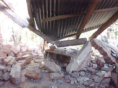
Recent earthquakes and tsunamis in Haiti, Indonesia and Japan killed
over half a million people, highlighting the need for better seismic
hazard detection. In particular, potential earthquakes around the
Marmara Sea threaten social and economic development in one of the most
densely populated parts of Europe.
As such, this area is the focus of the
MARSITE
project. It aims to prepare regions for geological disasters at a
European level by coordinating research by seismologists, engineers and
gas geochemists.
So far, scientists have painted a more accurate picture of the
area's seismic risk by mapping active faults and analysing historical
earthquake data. The team built long-term disaster management systems to
continuously monitor potential earthquakes, tsunamis, landslides and
chemical–radioactive emissions by harmonising land, sea and space-based
observation stations.
MARSITE created a scenario database for earthquake-triggered
tsunamis to advance early warning and rapid response systems for the
Marmara area and the city of Istanbul. Researchers calculated risk
probabilities for the next 5-, 10- and 50-year periods, and developed a
3D model to simulate ground motions for possible earthquake scenarios.
This ongoing research will help decision makers develop disaster
mitigation policies in the high-risk Marmara region and improve the
community's emergency response through public awareness. As these
findings are applicable to other earthquake-prone areas, it will also
advance global early warning detection systems.


 EN
EN  CS
CS DE
DE ES
ES FR
FR HU
HU IT
IT PL
PL PT
PT РУ
РУ SK
SK TR
TR УК
УК AR
AR 中文
中文